
Page 140 - TINA Dergi Sayi 10
P. 140
TINA
Denizcilik Arkeolojisi Dergisi
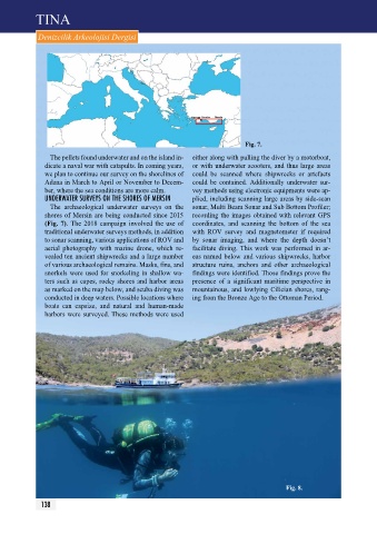
Fig. 7.
The pellets found underwater and on the island in- either along with pulling the diver by a motorboat,
dicate a naval war with catapults. In coming years, or with underwater scooters, and thus large areas
we plan to continue our survey on the shorelines of could be scanned where shipwrecks or artefacts
Adana in March to April or November to Decem- could be contained. Additionally underwater sur-
ber, where the sea conditions are more calm. vey methods using electronic equipments were ap-
unDerwAter SurVeYS On tHe SHOreS OF merSIn plied, including scanning large areas by side-scan
The archaeological underwater surveys on the sonar, Multi Beam Sonar and Sub Bottom profiler;
shores of Mersin are being conducted since 2015 recording the images obtained with relevant GpS
(Fig. 7). The 2018 campaign involved the use of coordinates, and scanning the bottom of the sea
traditional underwater surveys methods, in addition with ROV survey and magnetometer if required
to sonar scanning, various applications of ROV and by sonar imaging, and where the depth doesn’t
aerial photography with marine drone, which re- facilitate diving. This work was performed in ar-
vealed ten ancient shipwrecks and a large number eas named below and various shipwrecks, harbor
of various archaeological remains. Masks, fins, and structure ruins, anchors and other archaeological
snorkels were used for snorkeling in shallow wa- findings were identified. Those findings prove the
ters such as capes, rocky shores and harbor areas presence of a significant maritime perspective in
as marked on the map below, and scuba diving was mountainous, and lowlying Cilician shores, rang-
conducted in deep waters. possible locations where ing from the Bronze Age to the Ottoman period.
boats can capsize, and natural and human-made
harbors were surveyed. These methods were used
Fig. 8.
138