
Page 80 - TINA Dergi Sayi 11
P. 80
TINA
Denizcilik Arkeolojisi Dergisi
Starting from the north, there are a few monumental tell that the stoa maintained its representative feature
tombs and sarcophagi along the eastern coast, again welcoming the people arriving in the inner port fol-
facing the harbor (fig. 6) . lowing this incorporation despite some alterations.
9
Their form also reflect typology of the Roman According to available data, almost all of the build-
temples. When moved to the south, to the north of ings on the northern part of the promontory (or pen-
Tepecik, there is an early Christian church, a little insula) which separated the inner harbor from the rest
further from the shore, which can certainly be seen of the bay, were built during the 10th century AD,
10
from the sea . Although it was built on the grave of when the Eastern Roman Empire took Crete back from
a Christian saint, it seems to have been intentionally the Arabs (961 AD) or immediately afterwards. The
made to be seen from the harbor. fortifications enclosing them, but most
However, the Harbor Church importantly, their ortogonal settlement
lying at the entrance to the inner plan suggest that they were used for mil-
port to the immediate west of Te- itary purposes. So, for good reason, it was
pecik should have been meant to be claimed that the settlement was a castron .
13
seen easily by those arriving to the To the south of this castron lies an “empty”
city by sea. area of 60x40 m without any visible building
Due to its location, the Patarean remains on it. However, a survey conducted
Monument of the Roads, whose in the field during the last year’s campaign
blocks were reused for Late Antique revealed four in situ column shafts in total .
14
Forticifications should have been The distance between them and their posi-
erected very close to the inner harbor, tion in the area showed that they might have
at an “Harbor Agora” or at the junc- belonged to military ship sheds. They should
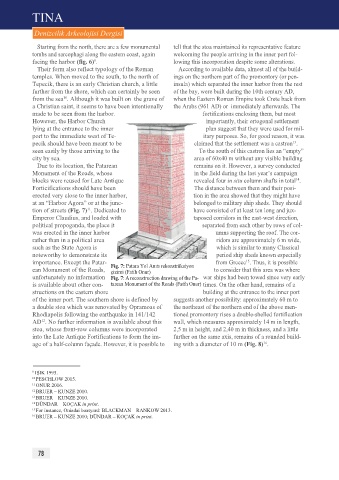
tion of streets (Fig. 7) . Dedicated to have consisted of at least ten long and jux-
11
Emperor Claudius, and loaded with taposed corridors in the east-west direction,
political propoganda, the place it separated from each other by rows of col-
was erected in the inner harbor umns supporting the roof. The cor-
rather than in a political area ridors are approximately 6 m wide,
such as the State Agora is which is similar to many Classical
noteworthy to demonstrate its period ship sheds known especially
importance. Except the Patar- Fig. 7: Patara Yol Anıtı rekonstrüksiyon from Greece . Thus, it is possible
15
ean Monument of the Roads, çizimi (Fatih Onur) to consider that this area was where
unfortunately no information Fig. 7: A reconstruction drawing of the Pa- war ships had been towed since very early
is available about other con- tarean Monument of the Roads (Fatih Onur) times. On the other hand, remains of a
structions on the eastern shore building at the entrance to the inner port
of the inner port. The southern shore is defined by suggests another possibility: approximately 60 m to
a double stoa which was renovated by Opramoas of the northeast of the northern end of the above men-
Rhodiapolis following the earthquake in 141/142 tioned promontory rises a double-shelled fortification
AD . No further information is available about this wall, which measures approximately 14 m in length,
12
stoa, whose front-row columns were incorporated 2,5 m in height, and 2,40 m in thickness, and a little
into the Late Antique Fortifications to form the im- further on the same axis, remains of a rounded build-
16
age of a half-column façade. However, it is possible to ing with a diameter of 10 m (Fig. 8) .
9 IŞIK 1995.
10 PESCHLOW 2015.
11 ONUR 2016.
12 BRUER – KUNZE 2010.
13 BRUER – KUNZE 2010.
14 DÜNDAR – KOÇAK in print.
15 For instance, Oniadai boatyard: BLACKMAN – RANKOW 2013.
16 BRUER – KUNZE 2010; DÜNDAR – KOÇAK in print.
78